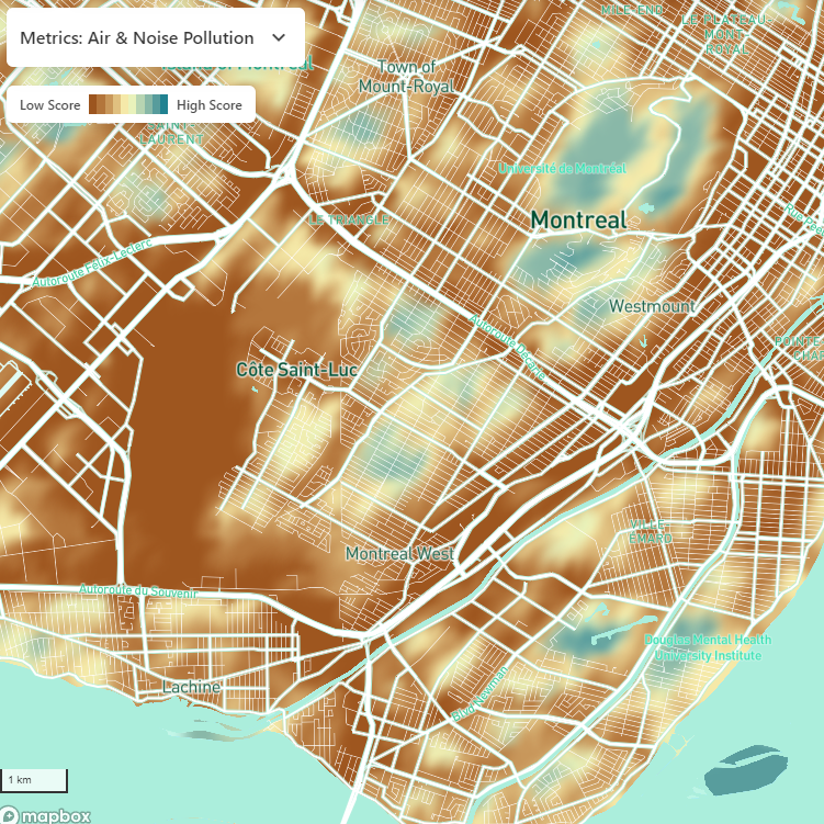
This index represents the potential air and noise pollution primarily from road, rail and aircraft. For every point on a 100m grid, we calculated, summed and scored:
Modelled traffic-related nitrogen dioxide levels within 100m
Major roads within 250m
Railways within 500m
Major airports within 1000m
Small airports within 500m
Ambulance and fire stations, and helipads within 500m
DATA SOURCES:
Road, rail, aircraft, ambulance and fire stations and helipads: Open Street Map
Modelled nitrogen dioxide levels: Hystad et al 2014-2016
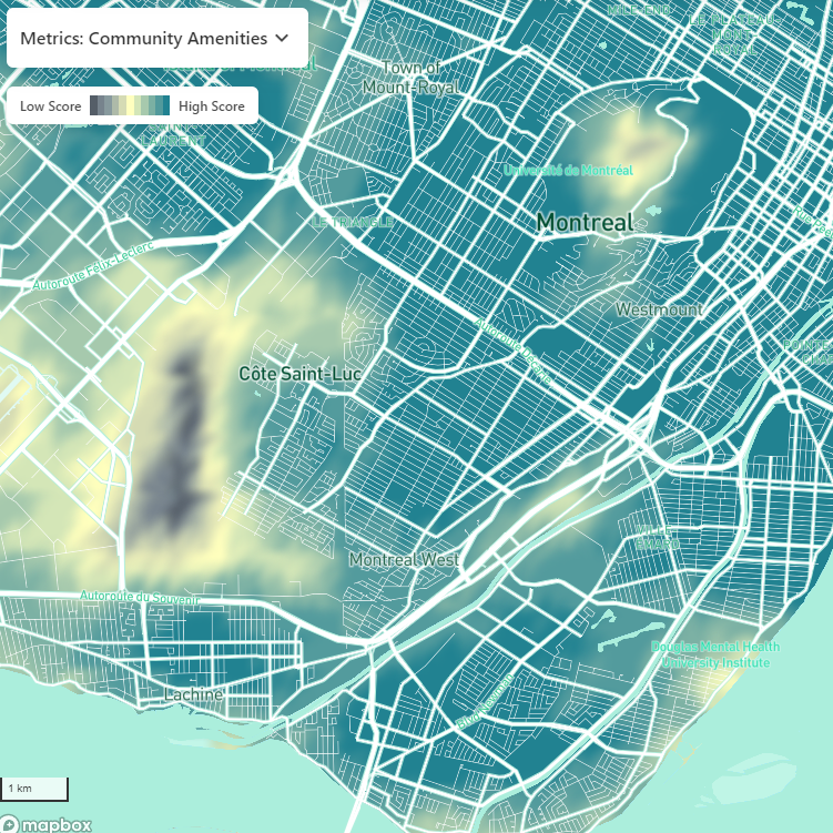
COMMUNITY AMENITIES INDEX
This index represents the density of destinations within a typical walking distance of 1000m. For every point on a 100m grid, we calculated, summed and scored:
Transit stops – bus stops, rail stops, etc.
Culture and entertainment- museums, churches, restaurants, etc.
Education – kindergarten to Grade 12, universities, ESL schools, etc.
Healthy food outlets – grocery stores, butcher shops, markets, etc.
Services – banks, health and medical clinics, etc.
Shopping – retail fashion, hardware, housewares, etc.